URNAVIO Aerial Systems & Engineering

Drone engineering, integration and maintenance in Iraq.

We turn mission requirements into a defined scope for system assessment, payload and sensor integration, fault diagnosis, and survey or inspection planning. We review your requirements before defining deliverables and cost.

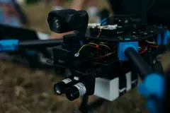
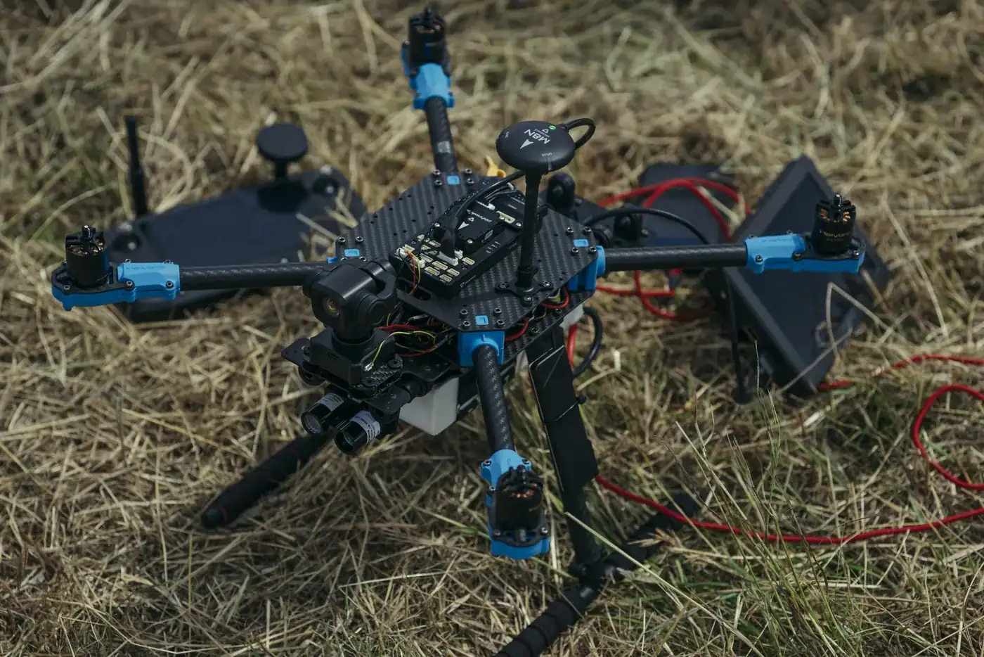
Multirotor aircraft on grass
Capability galleryAircraft and systemsExplore the gallery
URNAVIO / SOLUTIONS

Engineering and aerial services

We review requirements, resources, safety and relevant permissions before confirming feasibility, scope, cost and schedule.

Available to request

Technical assessment of aerial systems

If you are selecting a platform or reviewing an existing system, receive a requirements and architecture review with a proposed development plan.

Share the mission and current system specifications.

Engineering assessment
Available to request

Payload and platform integration

If you need to integrate a payload or sensor, we define the interfaces and deliver integration documentation and agreed test results.

Share platform, payload and interface specifications.

Payload integration
Pilot project

Aerial survey and inspection

When you need to document a site or asset, receive imagery or spatial outputs and a report within the agreed scope.

Share the site location, area and inspection objective.

Aerial survey and inspection
Available to request

Maintenance and technical support

For a reported fault, receive findings and recommendations for repair and verification. Repairs depend on suitable parts being available.

Share the model, fault description and available logs.

Drone maintenance
Fixed-scope pilot

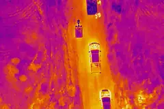
Thermal and visual inspection of solar panels

We inspect an agreed area of your site. Your team receives a map of findings, annotated images and priorities for field checks.

To get started, share the site location, system size and inspection objective.

Request a solar inspection pilot

Illustrative deliverable sample

The diagrams and example data show how a finding would be presented in the report.

Thermal and visual views

Illustrative thermal view with observation OBS-014 marked
Thermal schematic
Illustrative visual view of the same module
Visual schematic (RGB)

Review the visual view for possible shadows or surface soiling.

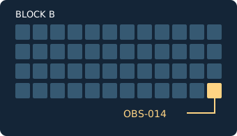
Location map

Array layout marking module 12 in string 04 of block B
Block B · String 04 · Module 12

Observations register

Observation ID
OBS-014
Finding
Localized thermal anomaly in a cell
Suggested priority
High in this example
Field verification
The site team checks the connections and junction box and determines whether electrical measurements such as an I–V curve or open-circuit voltage (Voc) are appropriate.
Request a site pilot
Case studies

Inspection scenarios in Iraq

Illustrative scenarios that show how we scope and deliver an inspection. They are not completed client projects, and the figures are examples.

Illustrative thermal view of a rooftop module
Illustrative scenario

CS-01 · Baghdad

Rooftop solar system on a commercial building

  • Solar inspection pilot
  • Commercial and industrial buildings

Challenge: The building owner needed documented evidence of module condition to support a warranty discussion, with limited time for roof access.

Modules in scope
320
Observations logged
6
High priority
1
Approach and deliverables

Approach

  1. Agree the roof area, access times and acceptance criteria.
  2. Capture thermal and visual imagery of the agreed area.
  3. Mark each observation on the array layout with a suggested priority.

Deliverables

  • Observation map
  • Annotated thermal and visual images
  • Priority list for field verification
Request a similar inspection
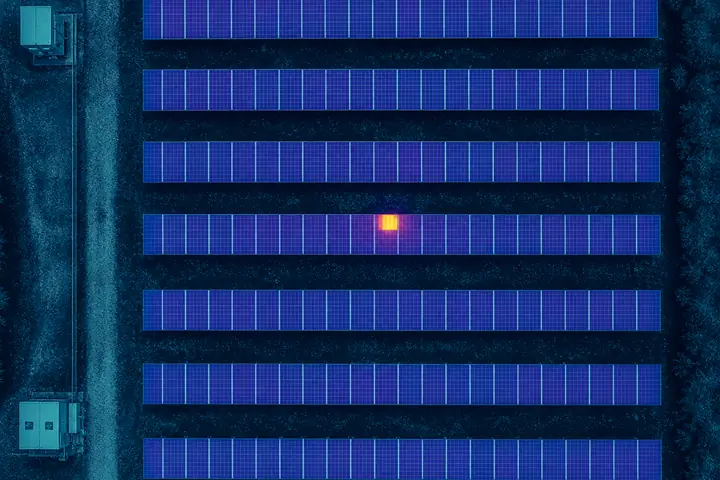
Illustrative thermal view of ground-mounted solar strings with one warm module
Illustrative scenario

CS-02 · Basra

Section of a ground-mounted solar plant

  • Solar inspection pilot
  • Operations and maintenance

Challenge: The maintenance team wanted to direct a limited number of site visits to the strings most likely to need attention.

Strings in scope
48
Observations logged
9
For field check
3
Approach and deliverables

Approach

  1. Agree the block boundary and reporting format with the maintenance team.
  2. Fly the thermal survey when sunlight conditions are suitable.
  3. Log each observation by block, string and module.

Deliverables

  • Observations register
  • Location map by block and string
  • Suggested field checks, such as connections and I–V measurements
Request a similar inspection
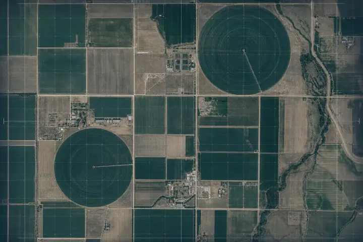
Illustrative aerial map of farm fields with centre-pivot irrigation circles
Illustrative scenario

CS-03 · Karbala

Coverage map for irrigated fields

  • Aerial survey and inspection
  • Agriculture

Challenge: Field management needed to identify the areas that called for closer inspection before the irrigation season.

Pivot circles
2
Scope coverage
100%
Areas to inspect
5
Approach and deliverables

Approach

  1. Agree the field boundaries and the required accuracy.
  2. Fly parallel survey lines for full coverage.
  3. Mark candidate areas for field inspection on the map.

Deliverables

  • Aerial coverage map
  • Suggested areas for inspection
  • Dated imagery for later comparison
Request a similar inspection

How we work

  1. Requirements

    Agree on the mission and what you need at handover.

  2. Assessment

    Review feasibility and resources, then define scope and cost.

  3. Delivery

    Carry out the agreed work and document observations.

  4. Verification and handover

    Review the outputs with you against the acceptance criteria.

About URNAVIO and our team

URNAVIO is an engineering team focused on civil aerial systems in Iraq, from assessment and integration to maintenance and inspection.

Development and collaboration

Before your project

Frequently asked questions

Answers about technical assessment, integration, deliverables and quotes.

How do I request an assessment?

Share the mission or fault, the platform model, and any available photos or operating logs in your email. We review the information to determine the assessment scope and next step.

What can a survey or inspection deliver?

Deliverables can include aerial imagery, maps or a report. We agree on coverage, accuracy and file formats for the site and mission.

Can you integrate a payload on an existing aircraft?

We review the platform and payload specifications, interfaces, power and mass limits. That review determines feasibility and the tests required.

How is the quote determined?

We review the mission, site, resources and deliverables, then define the scope and price before agreeing to proceed.

Start here

How can we help?

Fill in the details to prepare a draft. Open it in your email app to send it.

Prepare your enquiry

We use your enquiry details to respond. Attach photos or operating logs in your email app after opening the draft.